Click here for the index of the Nanasaba 1st Season Development Diary
Good evening! I’m sou7, the author of this diary. Did you check out Day 6 of the Nanasaba 1st Season Development Diary?
It’s already Day 7, and I can’t believe a whole week has passed!
For today’s entry, I’ll be introducing Masaba Prefecture and Masaba City.
Masaba Prefecture
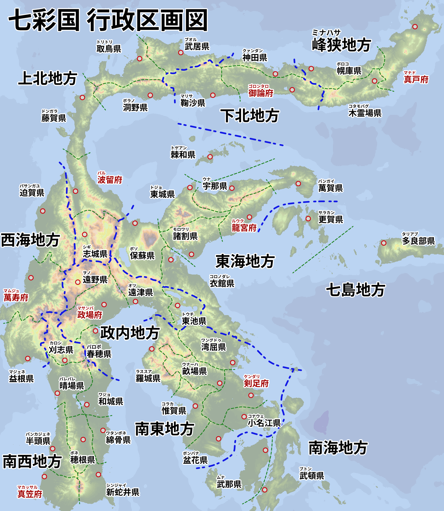
Masaba Prefecture is located in the central part of the map and belongs to the Masaba Region.
It is positioned right in the middle of the Masaba Region.
The prefecture features vast plains that can support large-scale development in the future.
Masaba City
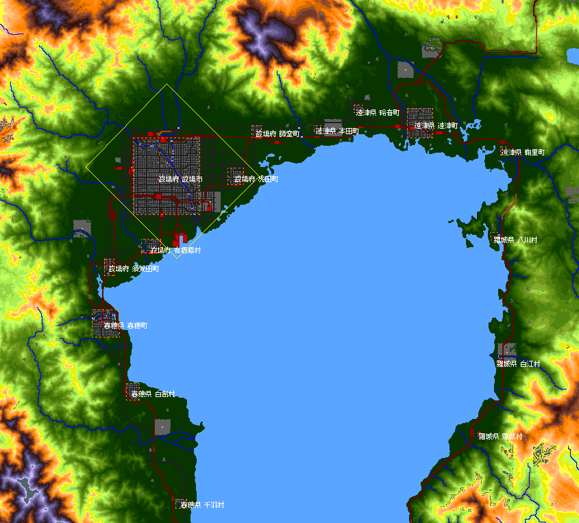
Masaba City is situated on the western side of a bay, right in the middle of the plains.
With a population of 147,000, it is the most populous city in the map.
Overview of the City
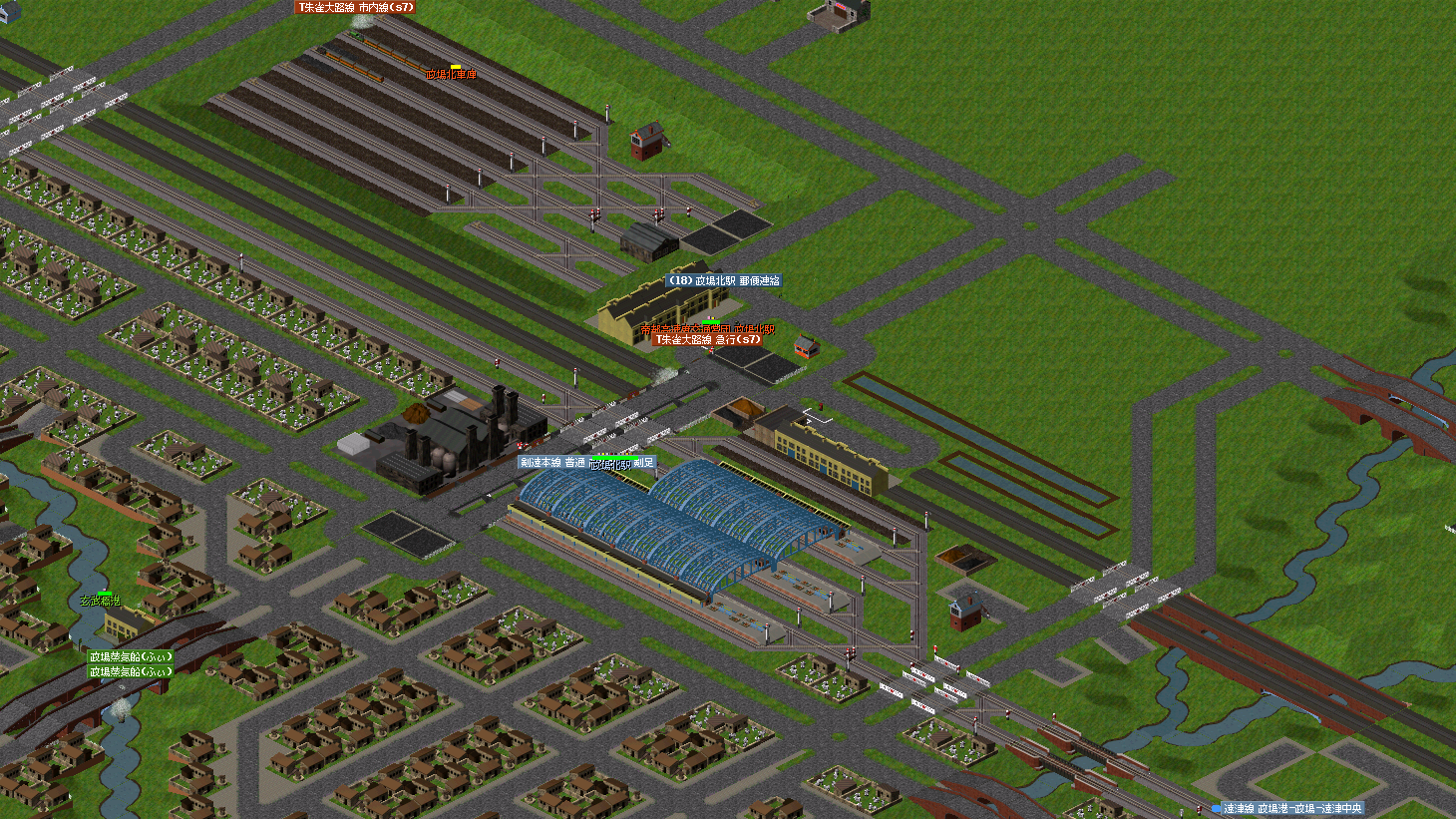
Here is a screenshot of Masaba City.
In the slightly southern part of the city is Masaba Station, in the north is Masaba North Station, and on the southern outskirts is Masaba Port.
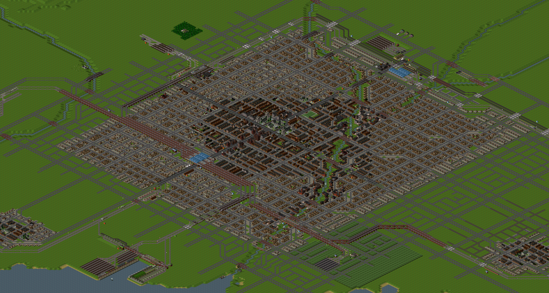
As mentioned in Day 1, Day 2, and Day 3, We’ve carefully designed the rivers in this playthrough.
As a result, Masaba City has a river running through it, and in particular, the eastern river is used for intra-city transportation by boat.
For details on boat-based transportation, see Nana-Iro Shipping Masaba Steam Line.
Masaba Station
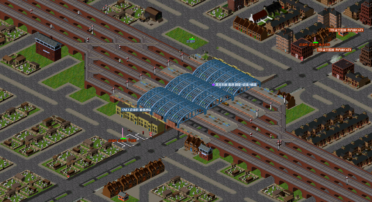
Located in the southern part of the city, Masaba Station serves both suburban trains and trains heading west.
The tracks are laid out for smooth east-west connections, making it an increasingly important hub in the future.
Masaba North Station
As reported in yesterday’s entry, this is Masaba North Station.
It has two through-platform tracks, four terminal-platform tracks, and one freight track.
Currently, it serves as the starting station for the Ryugu Main Line and Kenen Line.
In the future, its relationship with Masaba Station remains uncertain—specifically, whether its functions will be absorbed into Masaba Station.
(Personally, I hope Masaba North Station and Masaba Station remain separate, as my Suzaku Line, operated by the Teito Rapid Transit Authority, benefits from the passenger demand between the two stations.)
Masaba Central Station
Wait, where is the station? It seems to be missing…
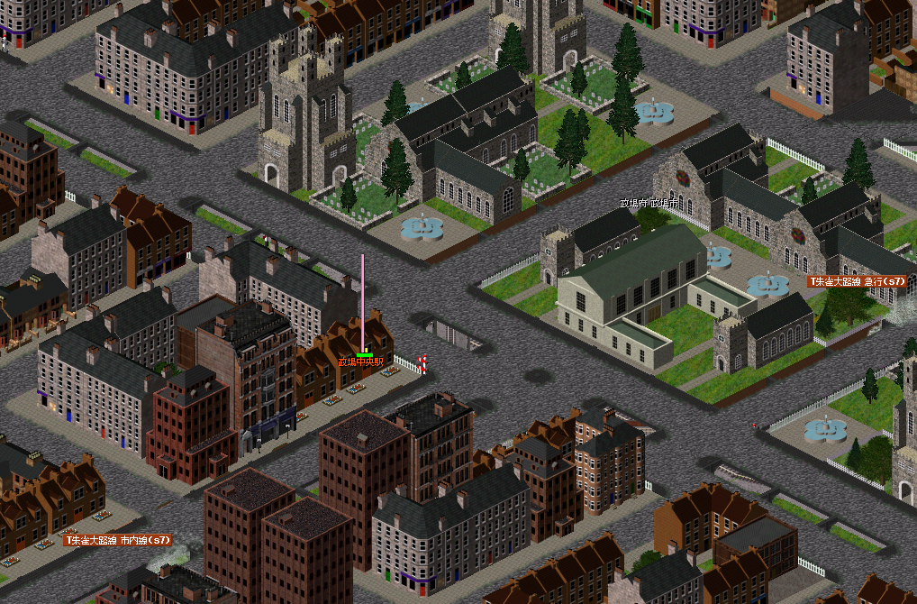
That’s right—Masaba Central Station is a subway station!
If you enable the height-cut view and look at a level below the surface, you can see the station.
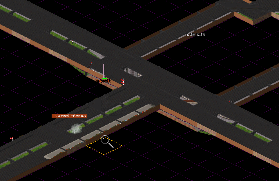
If you look closely, you can see that the tracks and station are built in an excavated area.
The structure covering it is something called an elevated tool.
Simutrans-Extended includes elevated tools, which are more versatile than the elevated roads and railways found in the Standard and OTRP versions.
They can be used in a variety of ways.
Why use elevated tools here?
Because subway stations don’t exist in this era!
After all, we’re using steam locomotives—if we built an underground station, the passengers would suffocate from the smoke!
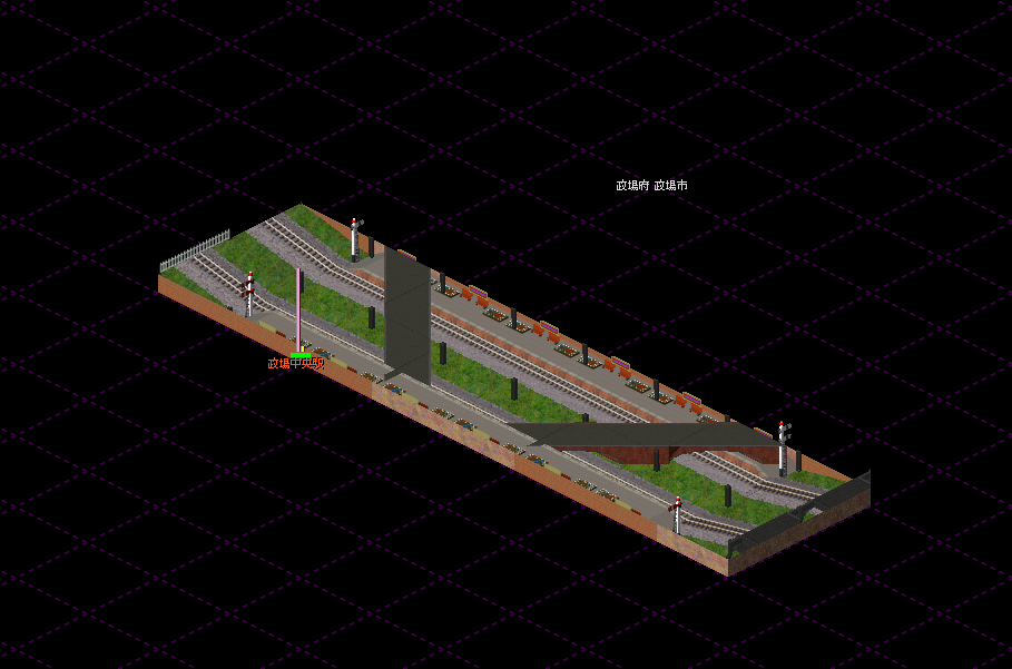
The deepest level of the railway looks like this:
- The upper level (Altitude -1) is the Suzaku Avenue Line of the Teito Rapid Transit Authority.
- The lower level (Altitude -2) is the Byakko Avenue Line of the same corporation.
The Suzaku Avenue Line uses brick elevated tools to avoid axle load restrictions.
This section required advanced elevated tool techniques, making it a challenging construction project in gameplay terms.
Masaba Port
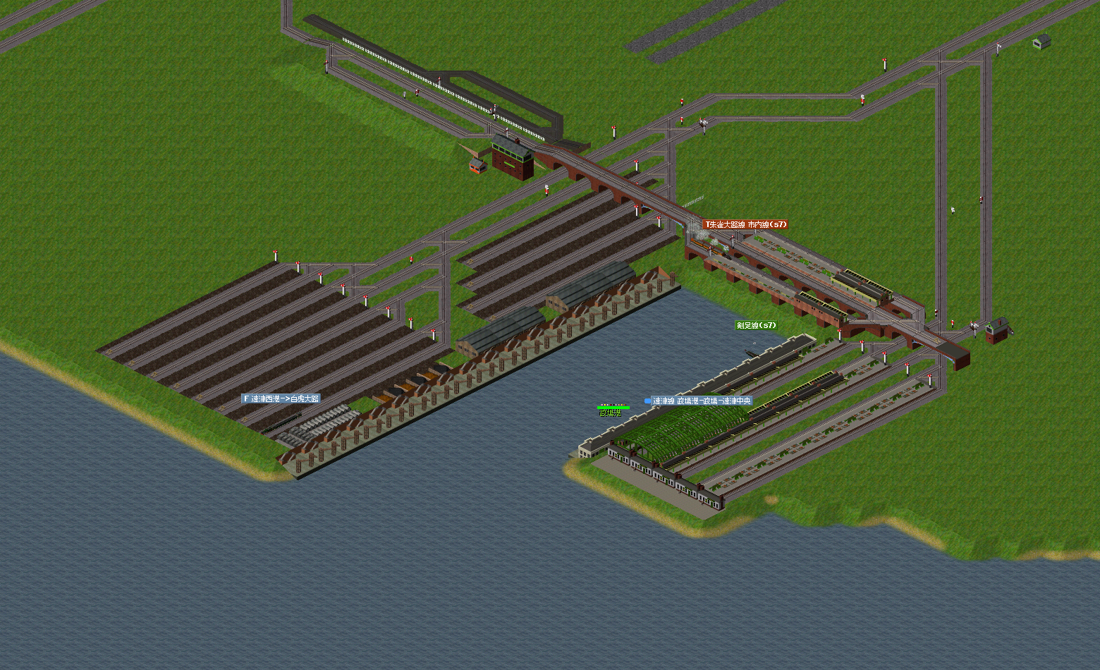
This is Masaba Port, located in the southern part of Masaba City.
It serves as the main hub for ship connections around Masaba, making it quite a large facility.
In the future, many freight trains will likely be stationed here.
The Suzaku Avenue Line and the Totsu Line operate services to this port.
There is significant commuter demand from workers in the port area.
That concludes today’s development report. I hope you enjoyed it!
Stay tuned for Day 8 of the Nanasaba 1st Season Development Diary!